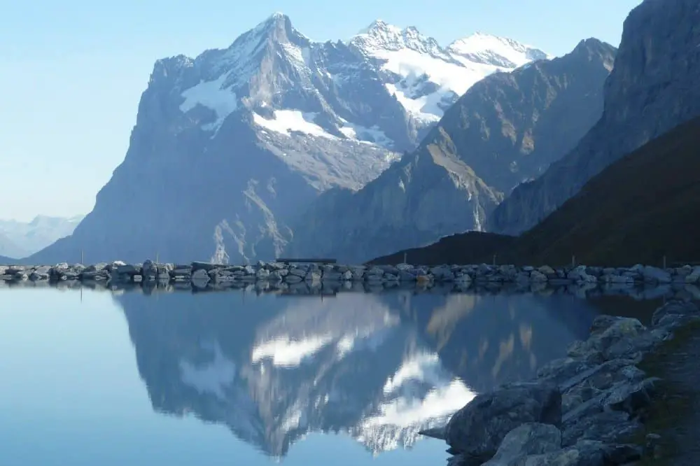
Whether you are a beginner or an expert hiker, Switzerland has some of the best hiking trails for everyone. The country is home to the Swiss Plateau and the Alps and features hiking trails of various difficulty levels.
From the classics such as the Eiger Trail to other newer trails, the whole of this European country is full of great trails that you can explore.
Besides exercising your body, hiking in Switzerland is a chance for some beautiful photography, making new friends, and sightseeing.
The trails here are also so well organized that even first time visitors can connect from one trail to the other- without much need for a tour guide.
So, are you ready to explore new and exciting hiking grounds? Here is a complete guide to hiking in Switzerland.
Seasons for Hiking
Depending on your timing, seasons for hiking in Switzerland can run all year round. Let me get into detail:
During winter, the weather is cold and you are likely to experience lots of snow on elevations starting from 5000ft and above, sometimes even lower. That said, you can still enjoy hiking on lower elevation or on winter trails that are groomed for hiking.
When spring starts in March, it is still chilly and snowy around the mountainous regions but the warmth frees up most elevations of up to 6500ft for hiking. This can, however, vary from one region to another and some trails may be muddy.
Early summer weather is warm and mild but as the season progresses towards July and August, more and more high trails become accessible and the best hikes in Switzerland open. The best time for high altitudes hikes is towards the end of summer, in September, when the weather is still summery but not too hot.
Outdoor activities start to reduce with the onset of fall. Hiking may still go past early October but higher trails start getting snow towards the end of the month. You can then decide on whether to hike based on how high you want to go.
The Best Time to go Hiking in Switzerland
Based on the information above, the best time to go hiking in Switzerland runs from late April through October, with a peak season experienced from June through August.
The peak season comes with a hike in accommodation, travel, and other expenses. This also means crowds of people- not entirely a bad thing if you get thrilled by the company of other hikers. The timing is also perfect for combining your hiking adventure with boating and swimming.
The peak season also comes with even busier weekends as travelers and Swiss nationals alike set out to hike. If big crowds are not your thing, lower your social interaction by hiking on weekdays.
The summer temperatures can get unbearably high; to be on the safer side, enjoy your hike earlier or later in the day.
If you are looking to save on your holiday expenses, April-June is a great time. People will have cleared the ski slopes and the peak season for hiking has not yet set in. Accommodation, travel, and admission fees are therefore cheaper. Still, you will be able to enjoy great views as snowfall will have reduced significantly.
Waiting out the hot summer temperature to the end of the hiking season is also an option. If you do, however, don’t wait until it’s October. Besides encountering the snowy onset of winter on higher elevations as I mentioned above, most trails also start closing. Most cable cars and cogwheel trains will also close for maintenance.
Safety and Comfort
How safe is hiking in Switzerland? To begin with, the country is one of the safest in the world. This means that even for a self-guided tour, you won’t have to worry about any muggings or robberies.
When it comes to the terrain though, safety depends on the route that you are taking and the surrounding features. See, most of the best hikes in Switzerland will take you through different parts of this mountainous country. And given the fact that snow is plenty in this part of the world, you have to worry about avalanches and slippery ground.
The issue of weather is actually the biggest safety concern. In the mountains, the temperatures can be in the mid-680 F and drop drastically within hours. In short, prepare for chilly weather no matter the season or where you will be staying- whether it’s a campsite or a resort.
What to Wear for Hikes in Switzerland
As the renowned fellwalker and guidebook author Alfred Wainwright puts it “There’s no such thing as bad weather, only unsuitable clothing.” In the Swiss outdoors this is a saying to live by.
To be on the safe side, dress warmly and most importantly, carry some additional clothes. Here are some tips for what gear you should bring on every hike:
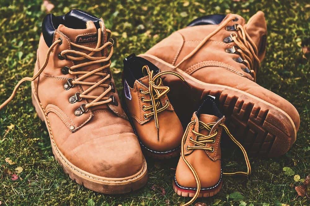
- Go for clothes that can be worn in layers. A sweater and a waterproof jacket (with a hood lined with fur) is a must.
- Don’t under any circumstance wear sneakers. The swiss terrain calls for good hiking boots/ shoes, plus woolen socks.
- Carry a small folding umbrella. Not only will it block the sun but an umbrella will keep the glare from the snow at a minimum while you rest.
- Wear sunglasses to reduce glare that can be damaging to your eyes.
- Even in the chilly weather, being outdoors for long is not good for your skin, wear and carry high SPF sunscreen. A wide-brimmed hat can also help with this.
- You should also bring a trekking pole, especially for hikes through the steep ground.
- Lastly, if you are going for a hike combined with rock climbing (a common outdoor activity in the country) remember to pack your climbing gear; rappels, harnesses, ropes, and so on.
Other Hiking Requirements
Apart from the gear, there are some extra info and recommendations to make your hike smooth and drama-free. Let’s look at some of these;
Permits:
Hiking is regulated in Switzerland and as such, no permits are required for hikers. There are no entry fees required to access national parks. Guides, however, require government approval for certain trails and difficulty levels.
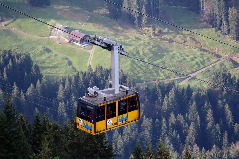
That said, you have to pay for cable cars or buses that move people from one mountain ridge to the other. You can avoid the transport cost by hiking up the mountains to get to the trails.
Expert Tip:
Acquire a Swiss Travel Pass. It comes at a discounted price for travel around most places in the country.
The Best Hikes in Switzerland
1. The Eiger Trail
Trail Length: 4.5 miles
Difficulty: Moderate
Time: 3 Hours
Elevation Gain: 3,195 feet
Directions: Click here
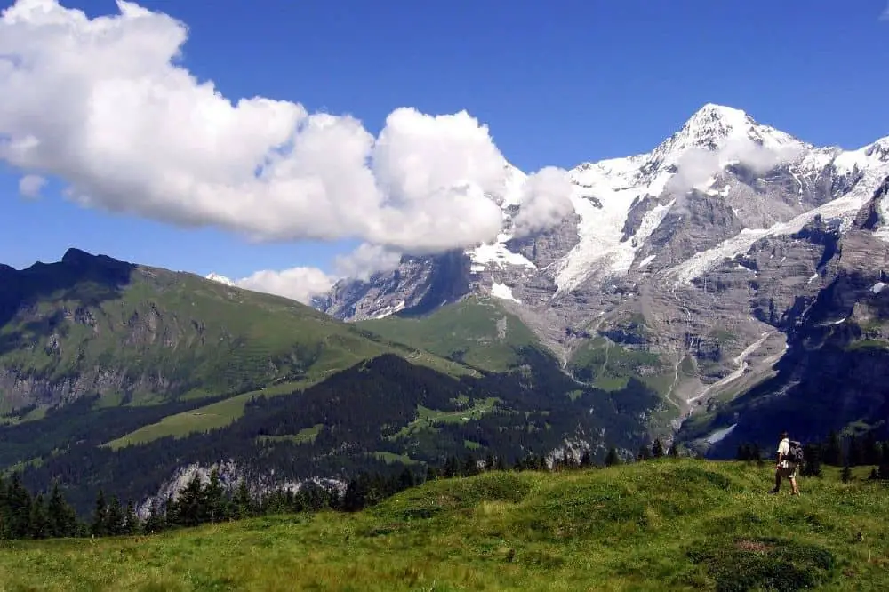
Are you geared up for a family hike? Head to the Eiger trail in the Jungfrau region of the Bernese Oberland (or highlands) of the western part of Switzerland. It is among the best hikes in Switzerland. Eiger, Jungfrau, and Monch are the three mountains in the region.
Besides wowing you with beautiful views of the Grindelwald valley, the trail is generally safe (even for kids). Nevertheless, it is not the route to take first-time young hikers or a stroller since the trail is downhill, mostly rocky and it can get slippery at times.
For your experienced little hikers though, the trail is just perfect as long as you pack enough food, water, and warm clothing to fight the chill. Be ready to assist them at a certain short stretch with some steep steps.
The point-to-point trail starts at Eiger Glacier station (Eigergletscher) and ends at Alpiglen. If you’re up for a challenge and don’t mind taking a little more time, you can start at Alpiglen and hike uphill to Eigergletscher.
Along the trail, you will enjoy the sight of cliffs, tiny waterfalls and streams cutting through the rocks, wildflowers, and an up-close view of the 3 mountains. What’s more, the trail is dotted with several picnic areas where you can catch your breath over some food.
How to Get There
Take a train from Kleine Scheidegg to Jungfraujoch, since Eiger glacier station is located in between. To reach there here’s some work for you.
First, head to Grindelwald-Grand station and get yourself a ticket to Kleine Scheidegg. At Kleine Scheidegg, alight and board another train to Jungfraujoch and get off at Eiger glacier station.
Is it the peak season? Be prepared to squeeze your way into scores of tourists headed to Jungfraujoch. On the brighter side, enjoy the picturesque views during the train ride and before you forget, alight at Eigergletscher.
At the station, there’s a restaurant and toilets to get refreshed before starting your hike.
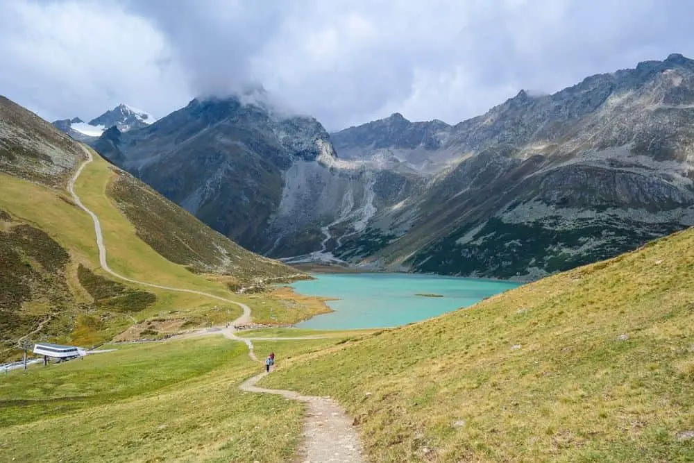
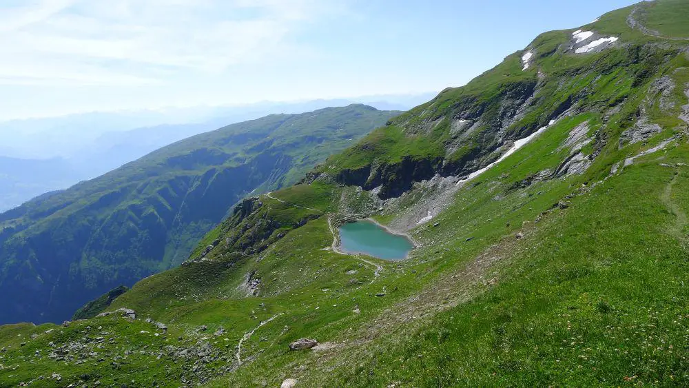
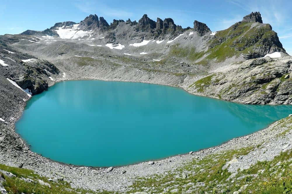
2. Pizol 5 Lakes Hike
Trail Length: 6.2 miles
Difficulty: Moderate to Hard
Time: 4-5 Hours
Elevation Gain: 1,666 feet
Directions: Click here
Some of the highlights of the Pizol 5-lakes hike include 5 beautiful mountain lakes, the Sardona Heritage Site, and a view of the Alps of Eastern Switzerland.
The trail, which is an amazing hike in Switzerland, is not very technical but due to its length and the up and down movements, it’s only recommended for kids of 8 years and above. That said, you will need hiking boots with a good grip and walking sticks.
The trail starts at Pizolhütte, accessed from Wangs by cable car, and ends at Gaffia.
The five lakes that you will encounter are Wangsersee, Wildsee, Schottensee, Schwarzsee, and Baschalvasee.
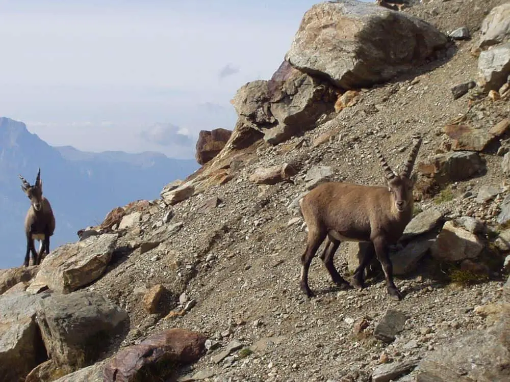
You get to see the last four lakes up close along the trail but for the Wangsersee, you will have to detour at the beginning of the hike or just be content viewing it from a distance. If you’re lucky, you will get to see an ibex, chamois, and eagles at the Schwarzsee.
Besides the 5 crystal clear lakes, you will also enjoy a beautiful view of the Glarus and the Grisons mountains. Other great sights include the Pizol glacier and stacked stones also called Steinmannlis.
If you manage to finish your hike early enough, take a chair lift down to Furt middle station and especially if you have kids in tow. Here, there are trampolines, swings and other play items as well as restaurants.
Wasserwald is another play area about 2 minutes from Furt. It is in a forest next to a river with plenty of water features to explore and a marble run. The last cable car down leaves at 17:30.
How to Get There
Take a train ride to Sargans, about 55 minutes from Zurich, then ride a bus to Wangs Pizolbahn. From the bus stop, the cable car station is just across. To reach the starting point, Pizolhütte, you will ride a cable car and two different chair-lifts.
The lifts are open between 8:15- 17:30 so it’s important to start your hike in time, to catch the last ride down if you don’t want to climb your way down.
3. Mürren Flower Trail
Trail Length: 1.2 miles
Difficulty: Easy
Time: 1 hour
Elevation Gain: 718 feet
Directions: Click here
This trail is one of the easiest ways to experience hiking in Switzerland. Even better, it is easy and short enough to go with kids making it one of the best hikes in Switzerland for families. It is another trail in the Jungfrau region and another option to enjoy the view of the peaks of Eiger, Jungfrau, and Mönch.
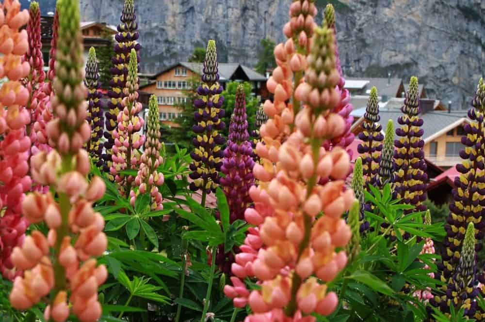
Do you love flowers? You or your kids will certainly enjoy exploring the 150 varieties of alpine flowers found at the beginning of the trail. Yes, the trail begins with a flower park which also doubles as a playground. You access it by an Allmendhübel funicular and then hike your way back to Mürren either using a dirt path or the road.
The path winds through fields and forests. It is narrow, bumpy and grassy but not too difficult for kids since it is downhill. As you dip in and out of the forest, the spectacular view of the mountain peaks keeps you company.
Hidden in the forests, you will find adventurous play equipment, occasional streams and a picnic area ready with fire pits and plenty of wood.
If you happen to have a stroller, you are better off using the road. Either way, you will end up in Mürren where you can walk and take the funicular back to the valley.
How to Get There
If not using a car, you’ll need to ride a train to Lauterbrunnen. From Bern via Interlaken Ost, the ride takes about 1h 36m. Then, take a bus to Stechleberg, Schilthorn. Buy a return ticket to Mürren and ride the Gondola.
Once you are there, follow the signs to Allmendhubel funicular station and take the funicular to the trailhead. For this part, you will only buy one ticket since you will hike back to Mürren.
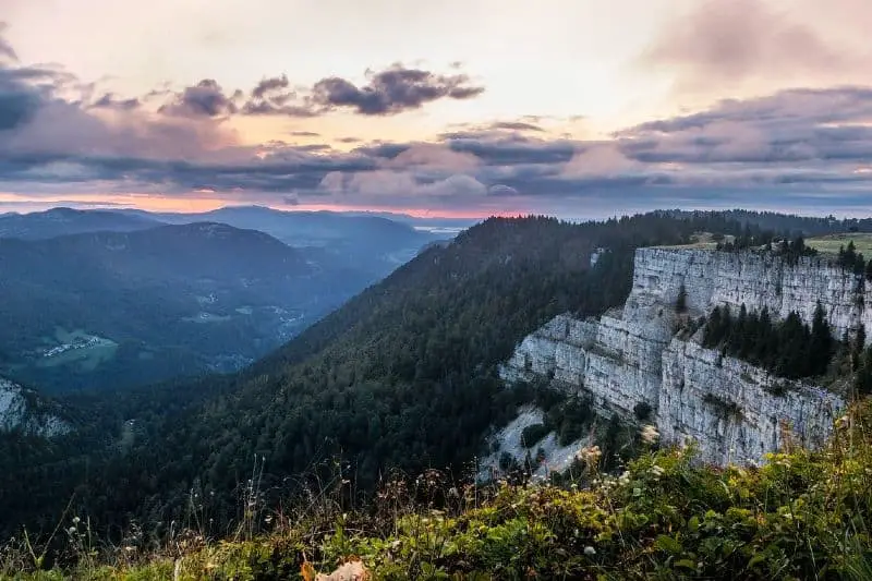
4. Creux du Van
Trail Length: 8.7 miles
Difficulty: Easy
Time: 4.5 hours
Elevation Gain: 2,395 feet
Directions:Click here
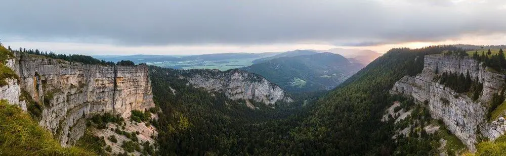
Creux du Van is a rock cirque, which is a crescent shaped natural rock formation. This horseshoe-shaped cliff is located in the Jura Mountains in the western part of Switzerland and is one of the best hikes in Switzerland. The rock is about 523 ft high and spans approximately 4,593 ft.
The hike is quite long but there are good resting points that overlook the 2.5 mile-long valley. Once at the top, you get a beautiful view of the midlands towards the Alps.
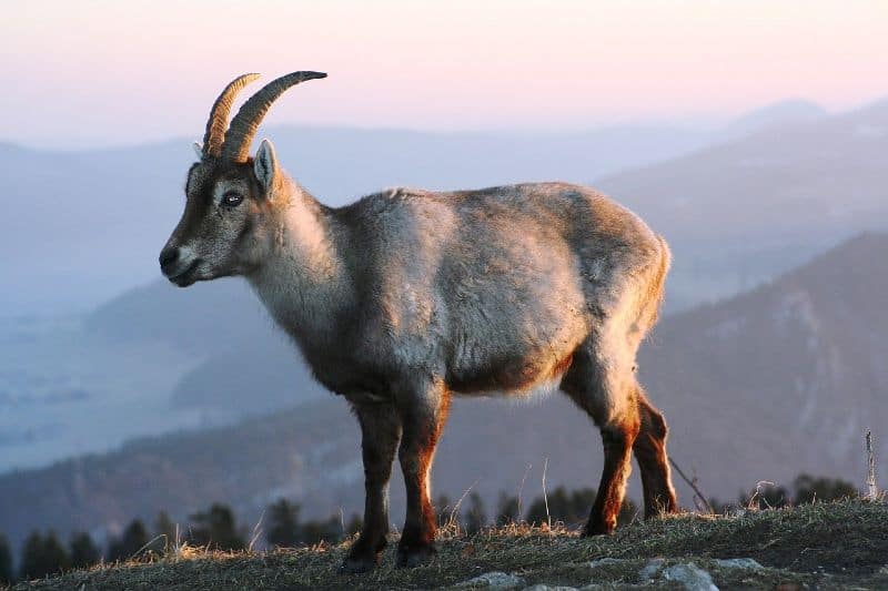
The Creux du Van is within a 9.6 square-mile protected reserve. An alpine forest grows here and is home to Ibex (fierce-looking mountain goats), chamois (goat-antelopes), lynx (wild cats), and other wild animals as well.
This trail runs along the structure which can be disorienting if you are afraid of heights or suffer from vertigo. The trail is open to hikers with dogs, as long as the pets are kept on a leash. It’s also okay to bring children along, but you need to be mindful of the sharp cliffs.
Having said that, the management has built a wall along the cliff to keep you and your loved ones from falling over. The trail along the cliff is about a 2.4 mile-long return trip.
The top of the structure is a flat plain where you can find great picnic spots, and even play around. It is also common to find hikers building campfires in the surrounding woods. If you would rather eat somewhere else away from the cliffs, there is a restaurant plus a playground near the car park.
How to Get There
Creux du Van is about 109 to 130 miles from Zurich, it all depends on the route that you take. The fastest way is to hire a car and drive up to the la ferme du Soliat, a small farm next to the cliffs.
To do the full 8.7 miles you need to trek up the cliffs. Public transport is best for this. Take a bus to Noiraigue (the closest bus stop) and hike up for about 2.5 miles to the top.
5. Hornlihutte Trail
Trail Length: 5.5 miles
Difficulty: Moderate
Time: about 2 hours
Elevation Gain: 2,185 ft
Directions: Click here
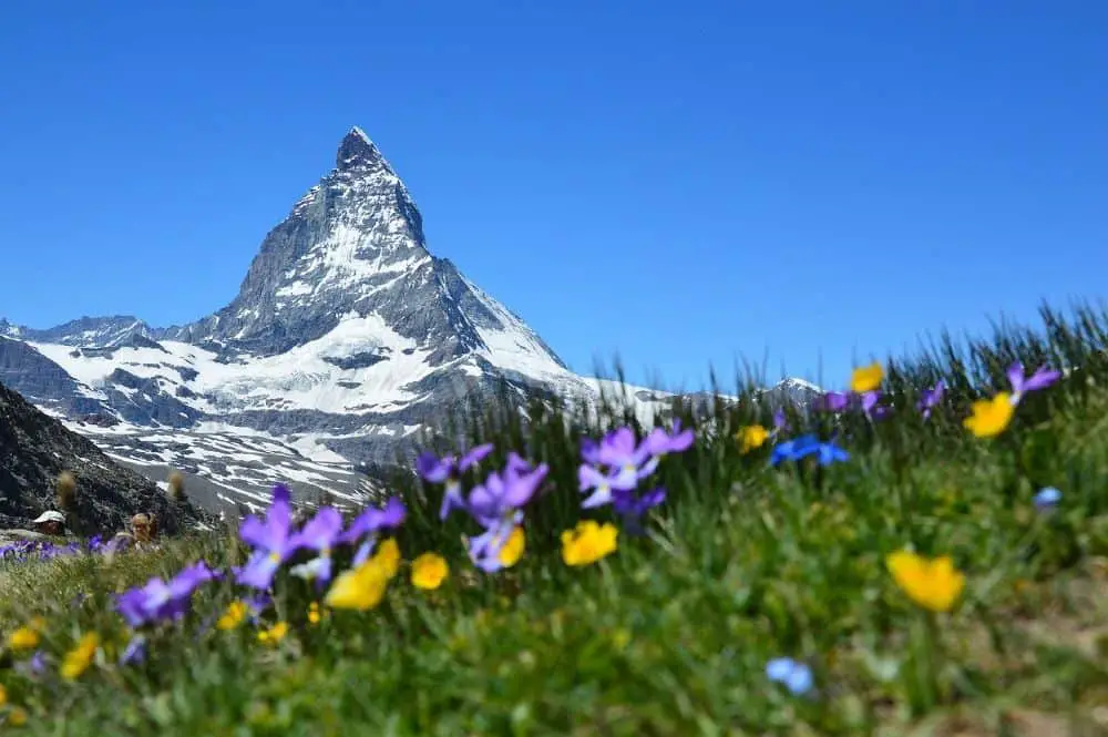
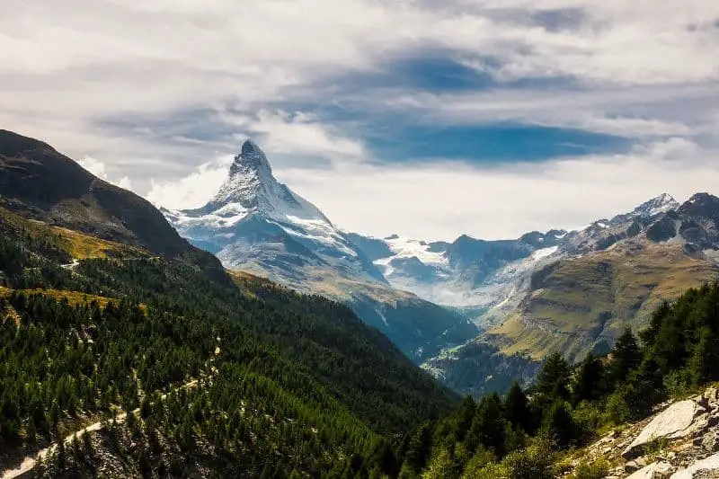
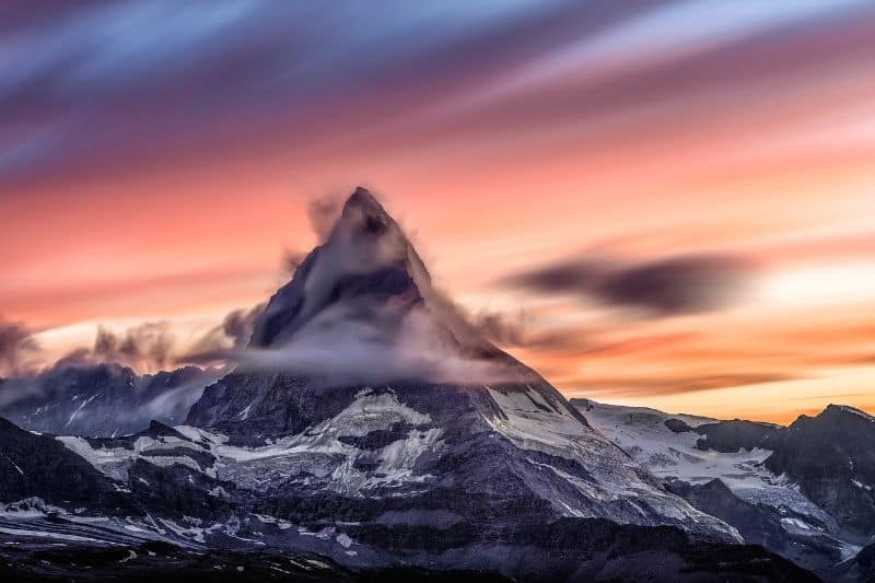
One other good reason to go hiking in Switzerland is to see the Matterhorn. This is a triangular shaped mountain in the Alps. Why hike the Hornlihutte trail? Simple, the trail is located in Zermatt, home to the iconic Matterhorn.
The area has several trails with the Matterhorn being the center of attraction. Besides the mountain, the Hornlihutte trail, also known as Hornli Hut, gives you a great view of other peaks in the Alps; Dent Blanche and Weisshorn peaks.
This moderate trail also gives you a good view of the glaciers along the Italian-Swiss border. These include the Lykasymm, Monte Rosa, and the Breithorn glaciers. So, don’t forget to bring your long-range camera for these picture-worthy opportunities.
As a popular tourist town, Zermatt sees hundreds of visitors who end up on the trail. To avoid the crowds, the trail is best hiked early in the morning when the traffic is light.
Also, you should be mindful of the weather. The trail is exposed and any snowfall in the area makes the paths slippery. Bring a good pair of hiking boots and a trekking stick. It’s also a good idea to bring drinking water to last you the entire 5.5 miles out and back hike.
Although the trail is termed as moderate, there are a few switchbacks at the end that can prove difficult. These are steep paths and when the weather is bad, they can be impossible without spiked shoes for better ground grip.
Caution: For beginners, it’s best to end your hike before these switchbacks. They are about 0.2 miles-long to the last marker. So, even if you decide to turn back, you won’t have missed much.
How to Get There
The Geneva to Zermatt route is well-traveled and accessible. On average, there are about 15 trains on the route with the fastest taking 3h 44minutes.
The timetable begins at around 5.30 in the morning with the trains leaving for Zermatt approximately every 1h 30 minutes. This is a scenic route with lakes, valleys, vineyards, and mountain ridges along the way.
6. Walker’s Haute Route
Trail Length: 121 miles
Difficulty: Hard
Time: 6-15 days
Elevation Gain: 49,876 ft
Directions: Click here
This trail reminds me of the 96 mile-long Lone Star Hiking Trail in Texas, US. Not for the terrain but the length and endurance required to complete. At a whopping 121 miles, this is one of the longest hiking trails in Switzerland.
The trail is made of a series of interconnecting trails. Depending on your starting point and the paths you choose, the trail can total up to 141 miles. Due to these variations and your speed, the time you need to complete them can range from 6 to 15 days.
This multi-day hiking route starts in Chamonix, near Mont Blanc Massif in France. It ends in Zermatt, Switzerland with the breath-taking Mount Matterhorn right above the trail. Whichever paths you use, the trail takes you through magnificent sceneries of over 10 mountain passes in the alps.
If you are a beginner, you do not need mountaineering equipment to complete the trail. Over time, hikers have been able to develop an easy route between Chamonix and Zermatt that does not include rock climbing or very steep ground.
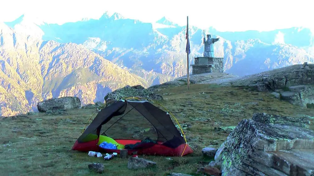
For this trail, you will need all your hiking gear; not forgetting warm clothes. Camping gear is also a must if you decide to spend the nights out in the open. However, there are well placed accommodation options along the route to cater for both fast and slow hikers..
As it happens, the Walker’s Haute Route is a variation of 13 different routes.
Experts also advise that you be accompanied by a certified and experienced guide. The guide is to direct you on the right paths depending on the time that you want to spend between the starting and the finishing point.
How to Get There
To get to Chamonix by plane, the easiest option is to fly to Geneva and connect to the town using a bus. It takes a little over 2 hours to get to travel from the airport to Chamonix.
For a more scenic route, you can take a train ride from Geneva. The ride will, however, involve some transfers along the way. From the Genève train station, the new Léman Express will take you to Saint-Gervais, Le Fayet, France. Then, connect to Chamonix using the Mont Blanc Express train.
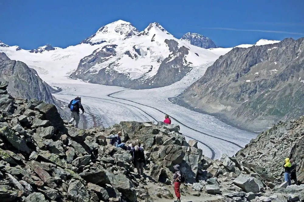
7. Aletsch Glacier Panorama Trail

Trail Length: 7.7 miles
Difficulty: Moderate
Time: 3.5 hours
Elevation Gain: 1,573 feet
Directions: Click here
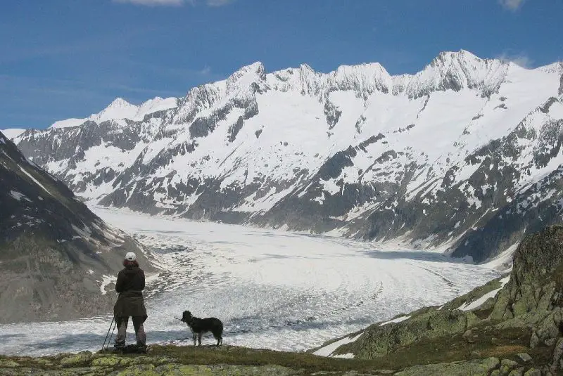
Even as global warming takes effect, the glaciers in Switzerland haven’t changed much. The magnificent Aletsch Glacier is the biggest in the Alps. It’s a UNESCO World Heritage site, and it is among the most beautiful sights in the Alps.
The area around the glacier is popular with tourists and is served by ski resorts and villages. Besides skiing, the glacier offers one of the best hikes in Switzerland. It is located in Valais, or Wallis in German, in the southern region of the country.
The hike also takes you along the Lötschberg rail line that connects Bern to Valais. Here, the views include viaducts, suspension bridges, a massive forest, and historic irrigation channels along the railway line. Hikers also get the chance to spend nights in inns right in the glacial mountains.
Lastly, the trail ends with a walk towards one of the villages with an excellent view of the snowy peaks of the Alps. For the hike, you need to be in a good shape and have no fear of heights.
One of the most challenging sections of the trail is crossing the Massa valley on top of a suspension bridge. Since you will be walking on ice most of the time, warm hiking shoes are a must. A warm jacket and woolen scarf will also be handy, protecting you from the glacier’s chilly wind.
A trekking stick is also advisable and of course a few water bottles. There are a number of eateries along the route where you can eat and rest on your way to completing the hike.
How to Get There
To get to the trail, take a train from Zurich to Riederalp. This is a 69-mile long journey that takes you near the Aletsch Glacier. From the station you will take a series of cable cars to the Moosfluh upper cable station, where the trail starts.
The trail ends at the Fiescheralp upper cable car station. From here it’s a scenic ride down to the train station from where you can connect back to Zurich.
8. Rheinfall Waterfalls Hike
Trail Length: 8.7 miles
Difficulty: Easy to Moderate
Time: 4 hours
Elevation Gain: 460 ft
Directions: Click here
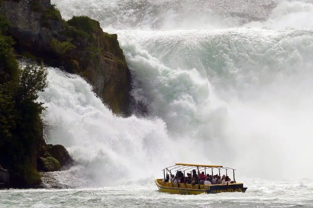
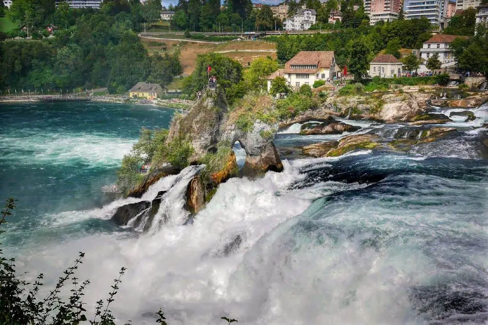
Apart from the glaciers that make hiking in Switzerland so iconic, what about hiking near Europe’s most powerful waterfall? I’m talking about the 490 ft wide and 75 ft high Rheinfall waterfalls, also known as the Rhine Falls.
The Rhine is one of the major rivers in Switzerland flowing from the alps. It travels downwards passing through many countries including Liechtenstein, one of the smallest nations in the world. However, it is the waterfall in Schaffhausen, northern Switzerland that showcases the river’s true power.
The river cuts through the town, creating one of the best sceneries in the area. There are tourist boats to move people from one river bank to the other. What’s more, for a better view of the falls, observation decks have been erected at strategic points.
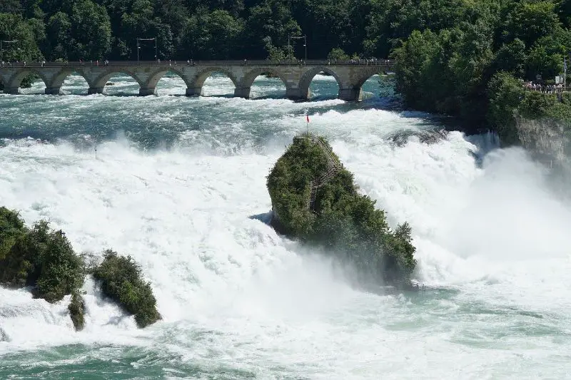
The 8.7-mile trail is part of the Via Rhenana hiking trail which follows the Rhine between Untersee and Hochrhein. Apart from the waterfalls, the route wades through woodlands, health resorts, rapids, and Roman-era ruins. A 17th-century monastery church also stands in the area.
While the whole ViaRhenana takes about 10 days, this section of the hike only takes about 4 hours to complete. Also, unlike most other hikes that are only accessible during summer and spring, the entire route is open to hikers and sightseers, all year-long.
The highlight of the visit, however, has to be a boat trip that takes you near and across the raging waters. To ensure that you get to enjoy the view fully, arrange to climb up the rock that sits in the midst of the 700,000 liters per second waterfall.
How to Get There
The Rheinfall Waterfall hike is one of the easiest places to reach during your hiking trip. From Zurich it will only take you 45 minutes to 1 hour to get to the trail.
The fastest and hustle-free option is taking a train from Zurich to the Neuhausen Rheinfall station or the Schloss Laufen am Rheinfall station. The two stops are located on either side of the river.
Final Thoughts
Being a mountainous country, most of the best hikes in Switzerland take you through hilly trails. The fact that the trails run across all difficulty levels ensures that the needs of all types of hikers are met. Better yet, you can choose to either go downhill or uphill on some of the trails.
Finally, hiking in Switzerland is more than just walking and burning up some calories; the picturesque landscapes, scenic mountain views, and other beautiful geographical features provide just the right blend for a tourist hiking adventure for the avid hiker.
